


Redundancy, redundancy, redundancy. The age old, and very wise I might add, advice when it comes to navigation on a boat. From paper charts, to chart plotters, to mobile tablets, and a handheld GPS — we use it all aboard s/v LAHO to get from point A to point B on our passages. And although our boat came equipped with an oldie goldie chart plotter, we knew early on we would need to amp up our navigational aids before setting sail, so we did just that.
Here’s what we use on the regular to safely cruise our way through the Bahamas and Caribbean…
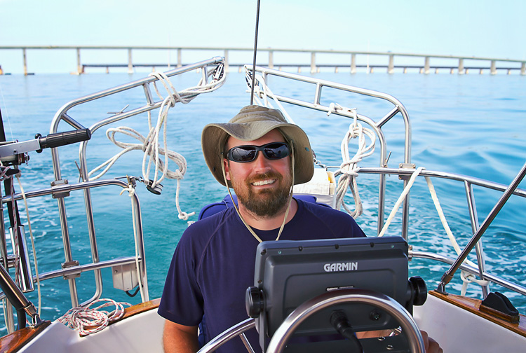
Garmin 2006C GPS Chart Plotter (binnacle-mounted in the cockpit) – This is the one that came with the boat at purchase, along with one single data card covering the coastal U.S. This chart plotter has since become our back-up GPS, if you will.
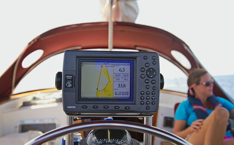
Finding additional data cards for this old, outdated chart plotter was like finding a needle in a haystack. :(( It took hours upon hours of internet searching to locate these antiquated data cards. They are no longer manufactured (obviously) and very rare to find online. We finally found the two we needed — a Bahamas one from an eBay seller and another Eastern Caribbean one from a random marine store in Connecticut.
iPad with cellular GPS capability – This is clearly one of the best and most useful purchases we made in preparation for our sailing journey. We use our iPad almost exclusively for GPS and route-planning. >>Ours<< is the kind of iPad with an active GPS chip. Without this, the iPad just uses wifi, and once you’re out of wifi range, it’s totally worthless (for GPS). So make sure you purchase one with the ability for a cellular (data plan) connection (3G or 4G), but don’t actually purchase a data plan through any provider. Does that make sense? Yes, no, maybe so?
Jereme handles the route-planning component of our passages and finds using the iPad to be super simple with its touch-screen interface. The regular old chart plotter is a pain in the you-know-what. We use Garmin’s BlueChart App (more on that below) as our primary navigation system.
After purchasing a SIM card from Batelco and having it cut to fit the iPad, we were also able to use our iPad for internet in the Bahamas. This worked out really well for us and gave us the internet connectivity we craved throughout the islands.

iPad Lifeproof Case![]() – A waterproof case is a necessity when on a boat with…um…tons of water surrounding your every move. Not to mention the occasional squall that pops up while en route to your next destination. What’s interesting to me is that the >>Lifeproof Case<< doesn’t actually enclose or cover the iPad screen (instead it creates a watertight seal around the edge of the screen so you can still use the touch-screen-interface with out any case-interference). What stinks about this is when you are getting bombarded by raindrops while simultaneously trying to use the iPad for navigation, the system goes a little haywire with all those extra raindrop “touches” on the screen. Your best bet is to try and keep the screen covered with a towel or something else when it’s raining like crazy. Regardless, this is the best product on the market to get the waterproofing job done!
– A waterproof case is a necessity when on a boat with…um…tons of water surrounding your every move. Not to mention the occasional squall that pops up while en route to your next destination. What’s interesting to me is that the >>Lifeproof Case<< doesn’t actually enclose or cover the iPad screen (instead it creates a watertight seal around the edge of the screen so you can still use the touch-screen-interface with out any case-interference). What stinks about this is when you are getting bombarded by raindrops while simultaneously trying to use the iPad for navigation, the system goes a little haywire with all those extra raindrop “touches” on the screen. Your best bet is to try and keep the screen covered with a towel or something else when it’s raining like crazy. Regardless, this is the best product on the market to get the waterproofing job done!
Garmin BlueChart Mobile App – Our “go-to” navigation system on our iPad. This particular mobile app is embedded with Active Captain (but if you hate the Garmin app, there are plenty of other app options out there also with Active Captain embedded). We picked >>BlueChart<< because the maker of it, Garmin, uses the Explorer Charts as their base maps which was perfect for us since we cruised through the Bahamas first! We also love that it stores all of our old routes/tracks. We do kinda wish it had slightly more robust analytics (like our trip ETA based on our speed), but what it does have is really really great.
Active Captain – We love. Period. This is another program altogether, but it’s actually embedded in the ^^BlueChart^^ app. It’s basically an interactive cruising guidebook that shows you other boaters’ reviews of marinas, moorings, anchorages, etc. with info on pricing, services, amenities, etc. etc. etc. We have made lots of decisions on where to sail to and/or anchor based on other cruisers’ reviews. Plus, the regular Active Captain system is totally FREE. We had this long before we had either the iPad or the BlueChart app. Anyone can use the online system by simply creating a username/password. Pretty nifty!
Skipper App – This is the app we used back in Naples for our regular day sails. It’s FREE (yay!) and works awesome in Florida since it uses NOAA maps (I believe), but is totally worthless once you get to the Bahamas/Caribbean because it does not really have any detail or data for that area of the world. In other words the maps within >>Skipper<< are not geographically correct whatsoever outside of the U.S.
^^We always think the handheld GPS screen should be on the top (not the bottom) of the device…so much so that we photographed it upside down. Whoopsie. ;))^^
Garmin Handheld GPS![]() – This is our backup-backup GPS device. But really, more so our anchor alarm. For about the first month of our life as cruisers I slept with our handheld GPS at my fingertips. Yes, slept with it since it serves dual purpose as a chartplotter GPS AND our anchor alarm! For newbie sailors, anchoring can be a little daunting and disconcerting to say the least. During our very first week of anchoring, I thought for sure we were dragging about every single time I looked outside. Lol. We weren’t of course, but the >>handheld GPS/anchor alarm<< provided some level comfort for me knowing that I could literally watch as the boat moved around the anchor (on screen) and not beyond the specific red zone we indicated.
– This is our backup-backup GPS device. But really, more so our anchor alarm. For about the first month of our life as cruisers I slept with our handheld GPS at my fingertips. Yes, slept with it since it serves dual purpose as a chartplotter GPS AND our anchor alarm! For newbie sailors, anchoring can be a little daunting and disconcerting to say the least. During our very first week of anchoring, I thought for sure we were dragging about every single time I looked outside. Lol. We weren’t of course, but the >>handheld GPS/anchor alarm<< provided some level comfort for me knowing that I could literally watch as the boat moved around the anchor (on screen) and not beyond the specific red zone we indicated.
^^Just a little Oliver photo bomb. He loves being part of the action.^^
This particular handheld GPS works with batteries OR a USB connection (which we always use on DC power). Our handheld GPS has also been terrific for taking along with us in the dinghy when we try to find a special snorkel spot using waypoints from charts or other cruisers.
Paper Charts – We swear by the Explorer Charts for cruising the Bahamas. They are “the charts” for Bahamas cruising. There are three different Explorer chartbooks you will need if you are cruising the Bahamas — Near Bahamas![]() , Exumas + Ragged Islands
, Exumas + Ragged Islands![]() , and Far Bahamas with Turks + Caicos
, and Far Bahamas with Turks + Caicos![]() . BUY THEM if you plan on cruising there! You will thank me later.
. BUY THEM if you plan on cruising there! You will thank me later.
We were also given a full set of CYC Charts for the Caribbean from a soon-to-be-retiring-from-the-cruising-lifestyle senior cruiser we met in the Berries. So SO nice of him! We haven’t had a need to use these just yet, but I’m sure we will after hurricane season wraps up and we start making the trek down the Eastern Caribbean to Grenada.
Speaking of paper products, we also finally began using Bruce Van Sant’s book “Gentleman’s Guide to Passages South: The Thornless Path to Windward”![]() once we started getting to some of the more remote Bahamian islands, and have been using it religiously ever since. Bruce provides an excellent roadmap for navigating the thorny path through the Caribbean.
once we started getting to some of the more remote Bahamian islands, and have been using it religiously ever since. Bruce provides an excellent roadmap for navigating the thorny path through the Caribbean.
Oh and we don’t have radar. I know, GASP!!! The horror. But we don’t. Sorry. At least we have an autopilot. :))
And finally, I’m sure someone is wondering what we do for weather in terms of navigating our passages. In other words, do we have/use an SSB radio? Surprisingly, we do own an SSB receiver, but never actually use it. Instead, we rely on passageweather.com, NOAA’s offshore weather report, and a few other websites for key weather-related info. We have not experienced any issues accessing the pertinent weather data at any of the spots we’ve cruised to thus far.
That’s our navigational toolbox for ya! Pretty fancy, eh? Not really, but we’ve had great success with ^^the gear^^ we use and don’t have any plans to change a thing. At least not with our current budget. ;)) If we were to upgrade anything, it would definitely be our old chartplotter. >>This GPSMAP 740 Marine GPS Navigator<<![]() would be our first choice for the price point.
would be our first choice for the price point.
>>Thanks for visiting LAHOWIND sailing blog! We’d love for you to get to know us and follow our story as we attempt to navigate a whole new world of sailing, as we cruise the Caribbean. …Learn more about us and our sailing + cruising adventures.
Hi thanks for sharing! Planning to get my first boat and will def refer back to this article. Safe travels and greets from Seattle!
Thanks for this post! Lots of great info.
We are onboard with the iPad plan and are glad to hear it worked out good in the Bahamas. We are currently using Navionics and we really like it for New England waters. Did you try any other navigation apps like the Navionics or iNavx?
Also, thanks for the tip on the SIM card from Batelco. Was it difficult to get it cut to fit the iPad?
Fair winds,
Jesse
Great post. Very informative. You guys do a great job on your blog post. Entertaining, thoughtful, useful, etc… THANKS, JC
Hi Jesse! Thanks! No, we didn’t try Navionics actually. I think we were considering it, but someone must’ve talked us out of it. Who knows. I’m not sure if Navionics is the same, but we really liked that BlueChart had the Explorer Charts as base maps and it has Active Captain embedded. As for the SIM card, it was a breeze to have the BTC folks cut it for us at the store. But kind of a pain to have to take in and out of the iPad when you have to “refill” your data plan. You have to remove it from the iPad and then insert the SIM card into a phone to reactivate it with a new data plan (by texting). Once we had the SIM card cut for the iPad, it was smaller than it should be for our BTC phone. So we had to line it up perfectly centered in the spot on the back of the phone whenever we ran out of a 2GB data card and reactivated. PS – Not sure how much internet you use, but make sure to stock up on data cards at the beginning of the Bahamas where there are actually BTC stores that have normal hours and people working in them. All the charts say there are stores throughout the islands, but NONE were ever open. Ever. And you cannot purchase additional data cards online or by phone. Just FYI. 🙂 -Kim
Great Blog guys! Beautiful photos! Love it! I hope to be a liveaboard soon! See you on the water!
Great information.Love your blog!